Project documentation
Clear visual records of site progress.

Consistent aerial and ground photography for construction projects across the Thames Valley and South East.
Document progress, communicate clearly with stakeholders and build a professional visual record from early works through to completion.
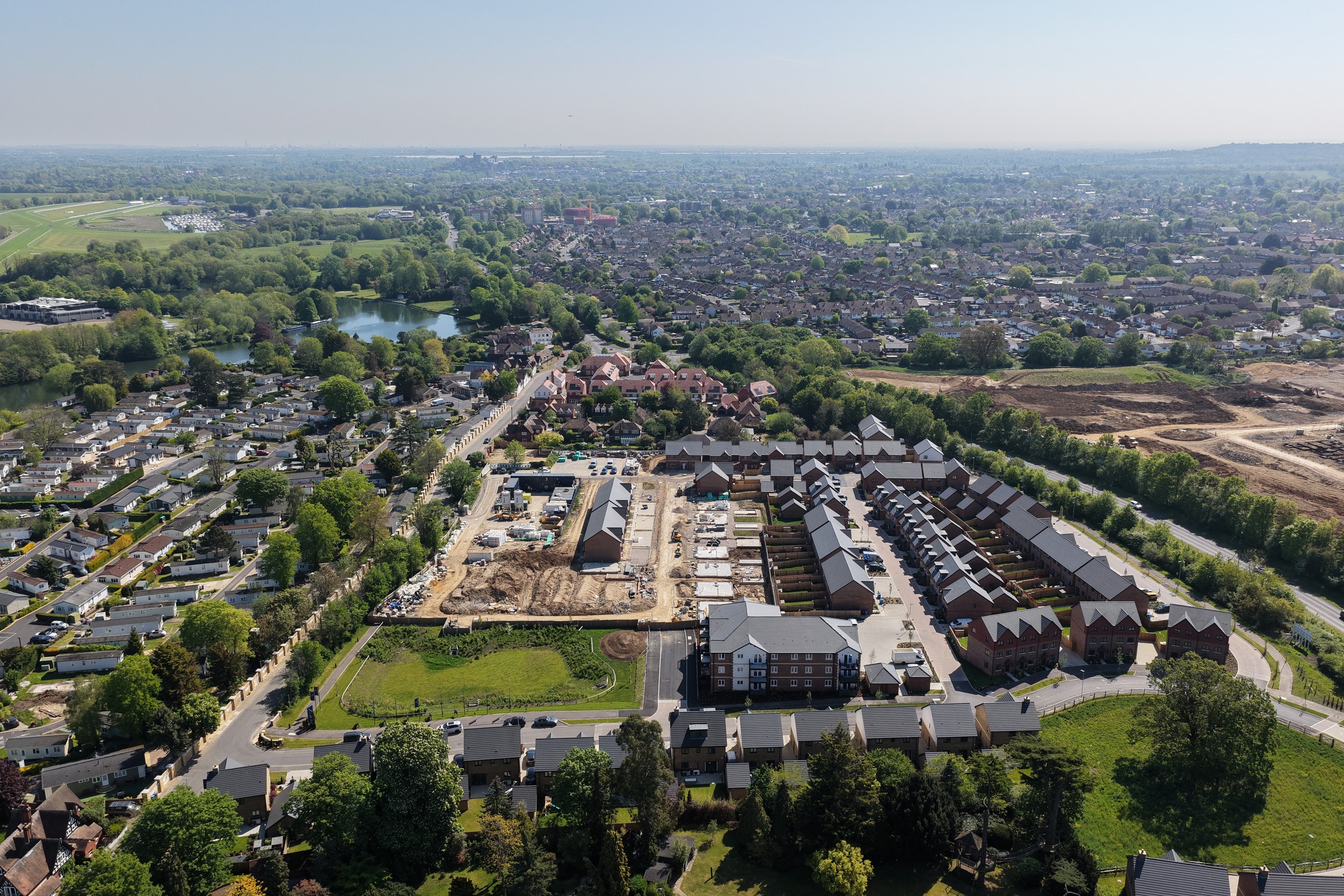
Construction sites change quickly.
Regular photography creates an accessible record of how a project develops over time, helping teams communicate progress internally, update stakeholders and build useful material for future marketing and case studies.
Altura combines aerial and ground-level photography to capture both the overall development and important detail on site.
Not every project needs scheduled visits.
Aerial and ground photography can be commissioned around significant stages such as:
This provides professional documentation at the moments that matter.
For longer projects, Altura can return at agreed intervals throughout the build.
Visits can be scheduled monthly, fortnightly or around a project programme, providing an organised visual record rather than disconnected photographs taken at random points.
For recurring assignments, aerial viewpoints and suitable ground-level camera positions can be recorded and reproduced across future visits.
Keeping viewpoint, framing and processing consistent makes change much easier to see.
The result is imagery that can be compared across weeks and months rather than a folder of unrelated site photographs.
Clear visual records of site progress.
Imagery for reports, presentations and client communications.
Professional photographs and video for websites, LinkedIn and project updates.
Quality material for case studies, tenders and future pitches.
Drone photography provides scale, site context and an overview of progress.
Ground-level photography captures details, materials, workmanship and perspectives that aren't useful from the air.
Combining both creates a substantially more complete record of the project.
Scheduled projects can also incorporate short aerial or ground-level video clips.
Across a longer development these can build into before-and-after content, progress films or completion material rather than disappearing after each monthly update.
Where appropriate, structured aerial capture can also provide orthomosaic imagery or wider site-overview material for visual communication.
These outputs are intended for documentation and communication rather than formal land-survey certification.
Each assignment is planned around the operating environment.
Altura can work within site procedures including inductions, designated operating areas and project-specific risk requirements, alongside appropriate drone flight planning and permissions.
Every job includes pre-flight planning, airspace checks and an on-site risk assessment before the drone leaves the ground.
Altura Aerial Co operates with GVC and A2 CofC qualifications and £5 million public liability insurance.
Flights are carried out with professional DJI drone systems chosen for reliable image quality, stability and commercial project requirements.
Altura Aerial is the specialist aerial brand of Fun in Elk City Limited, bringing web, photography, video and digital delivery experience to every project.
Altura Aerial is operated by Fun in Elk City Limited, combining aerial capture with photography, video and digital delivery capability.
Whether you need one milestone visit or scheduled coverage throughout the build, tell us about the site and project programme.